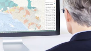
Spatial Analysis
Filter by
SubjectRequired
LanguageRequired
The language used throughout the course, in both instruction and assessments.
Learning ProductRequired
LevelRequired
DurationRequired
SubtitlesRequired
EducatorRequired
Results for "spatial analysis"
 Status: Free Trial
Northwestern University
Skills you'll gain: Mathematical Modeling, Mathematical Software, Automation Engineering, Engineering Calculations, Applied Mathematics, Engineering Analysis, Mechanics, Simulation and Simulation Software, Virtual Environment, Torque (Physics), Numerical Analysis, Control Systems, Spatial Analysis
 Status: Preview
Coursera Instructor Network
Skills you'll gain: Geographic Information Systems, Geospatial Information and Technology, Geospatial Mapping, Spatial Data Analysis, Spatial Analysis, Global Positioning Systems, Data Analysis
 Status: Free Trial
Skills you'll gain: SAS (Software), Network Analysis, Trend Analysis, Data Manipulation, Data Analysis, Forecasting, Data Quality, Text Mining, Data Visualization Software, Spatial Analysis, Dashboard, Analysis, Analytics, Data Visualization, Time Series Analysis and Forecasting, Business Analytics, Interactive Data Visualization, Data-Driven Decision-Making, Predictive Analytics, Business Reporting
 Status: Free Trial
University of California, Davis
Skills you'll gain: Spatial Analysis, ArcGIS, Geographic Information Systems, Geospatial Mapping, Data Quality, Data Mapping, Data Modeling, Data Management, Data Storage, Data Sharing, Data Manipulation, Relational Databases, Query Languages, Analytics
 Status: Preview
École Polytechnique Fédérale de Lausanne
Skills you'll gain: Climate Change Adaptation, Governance, Land Management, Community Development, Spatial Analysis, Sustainable Development, Economic Development, Environmental Policy, Transportation Operations, Fiscal Management, Finance, Socioeconomics
Ball State University
Skills you'll gain: Data Ethics, Machine Learning Algorithms, Supervised Learning, SQL, Unsupervised Learning, Graph Theory, Database Systems, Database Management Systems, Statistical Machine Learning, Financial Statement Analysis, Statistical Hypothesis Testing, Statistical Methods, Data Wrangling, SAS (Software), Spatial Analysis, Text Mining, Statistical Software, R Programming, Artificial Intelligence, Natural Language Processing

Skills you'll gain: Spatial Analysis, Geographic Information Systems, Scripting, Geospatial Mapping, Dashboard, Data Visualization Software, Data Processing, Interactive Data Visualization, Data Manipulation, Cascading Style Sheets (CSS)
 Status: Preview
Pontificia Universidad Católica de Chile
Skills you'll gain: Image Quality, Image Analysis, Computer Vision, Computer Graphics, Color Theory, Python Programming, Algorithms, Spatial Analysis, NumPy, Linear Algebra, Computational Logic
 Status: Preview
Duke University
Skills you'll gain: Spatial Analysis, Neurology, Human Learning, Psychology, Computational Thinking, Visual Impairment Education, Experimentation, Anatomy, Laboratory Research, Physiology, Biology, Magnetic Resonance Imaging

Skills you'll gain: Geospatial Information and Technology, Geospatial Mapping, Spatial Data Analysis, Geographic Information Systems, GIS Software, Spatial Analysis, Environmental Monitoring, Unsupervised Learning, Data Analysis Software, Image Analysis, Global Positioning Systems, Machine Learning, R Programming, Image Quality, Data Processing, Open Source Technology, Data Collection, Data Transformation, Dimensionality Reduction, Data Import/Export
 Status: Preview
École Polytechnique Fédérale de Lausanne
Skills you'll gain: Spatial Analysis, Geographic Information Systems, Geospatial Mapping, Spatial Data Analysis, Augmented Reality, Data Visualization Software, Data Mapping, Color Theory, Database Management
 Status: Preview
Universidad Autónoma Metropolitana
Skills you'll gain: Socioeconomics, Sustainable Development, Social Sciences, Geographic Information Systems, Environment, Systems Thinking, Cultural Diversity, Climate Change Adaptation, Public Health, Spatial Analysis, Digital Transformation, Governance, Transportation Operations, Climate Change Mitigation