Filter by
SubjectRequired
LanguageRequired
The language used throughout the course, in both instruction and assessments.
Learning ProductRequired
LevelRequired
DurationRequired
SkillsRequired
SubtitlesRequired
EducatorRequired
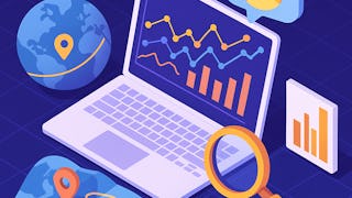
Results for "geospatial mapping"
 Status: Free Trial
Skills you'll gain: SAS (Software), Forecasting, Data Visualization Software, Time Series Analysis and Forecasting, Data-Driven Decision-Making, Predictive Analytics, Geospatial Mapping, Data Analysis, Geographic Information Systems, Data Manipulation, Data Transformation, Statistical Programming
 Status: NewStatus: Free Trial
University of Pittsburgh
Skills you'll gain: Data Storytelling, Interactive Data Visualization, Data Visualization Software, Data Presentation, Data Visualization, Tableau Software, Matplotlib, Geospatial Information and Technology, Spatial Analysis, Geospatial Mapping, Visualization (Computer Graphics), Seaborn, Infographics, Heat Maps, Data Ethics, Text Mining, Data Mapping, Network Analysis
 Status: Free Trial
Universidad de los Andes
Skills you'll gain: Spatial Analysis, NoSQL, Spatial Data Analysis, Geospatial Mapping, Geographic Information Systems, Big Data, MongoDB, File Systems, Apache Hadoop, Distributed Computing, Data Architecture, Cloud Computing, Apache Spark, Public Cloud, Database Systems, Data Processing, Scalability, Databases, Environmental Monitoring, Climate Change Programs
 Status: Preview
University of Illinois Urbana-Champaign
Skills you'll gain: Geospatial Information and Technology, Geographic Information Systems, Apache Hadoop, Spatial Data Analysis, Geospatial Mapping, Spatial Analysis, Big Data, Matplotlib, Data Processing, Computational Thinking, Distributed Computing, Data Manipulation, Python Programming
 Status: Free
École normale supérieure
Skills you'll gain: Data Visualization Software, Geospatial Mapping, Graphic and Visual Design, Statistical Visualization, Geographic Information Systems, Quantitative Research, Data Mapping, World History, Color Theory

Skills you'll gain: Spatial Data Analysis, Spatial Analysis, Geographic Information Systems, Geospatial Mapping, Data Presentation, Exploratory Data Analysis, Data Mapping, Descriptive Statistics, Data Access
 Status: Preview
École Polytechnique Fédérale de Lausanne
Skills you'll gain: Geospatial Mapping, Geographic Information Systems, Geospatial Information and Technology, Spatial Data Analysis, Spatial Analysis, Global Positioning Systems, 3D Modeling, Visualization (Computer Graphics), Survey Creation, Systems Of Measurement
 Status: Free Trial
Skills you'll gain: Data Visualization Software, Plotly, Data Visualization, Dashboard, Interactive Data Visualization, Matplotlib, Seaborn, Data Presentation, Data Analysis, Geospatial Information and Technology, Pandas (Python Package), Scatter Plots, Histogram, Heat Maps, Box Plots, Python Programming

Skills you'll gain: Geospatial Information and Technology, Geospatial Mapping, Spatial Data Analysis, Geographic Information Systems, GIS Software, Spatial Analysis, Environmental Monitoring, Unsupervised Learning, Data Analysis Software, Image Analysis, Global Positioning Systems, Machine Learning, R Programming, Image Quality, Data Processing, Open Source Technology, Data Collection, Data Transformation, Dimensionality Reduction, Data Import/Export
 Status: Free Trial
Coursera Instructor Network
Skills you'll gain: Process Mapping, Strategic Thinking, Process Analysis, Process Management, Business Workflow Analysis, Operational Efficiency, Business Process Improvement, Process Improvement, Lean Methodologies, Waste Minimization
 Status: Preview
The Pennsylvania State University
Skills you'll gain: Geographic Information Systems, Case Studies, Climate Change Programs, Systems Thinking, Design Thinking, Geospatial Information and Technology, Sustainable Design, Spatial Analysis, Collaborative Software, Decision Support Systems, Cultural Responsiveness
 Status: Preview
École Polytechnique Fédérale de Lausanne
Skills you'll gain: Spatial Analysis, Geographic Information Systems, Geospatial Mapping, Spatial Data Analysis, Augmented Reality, Data Visualization Software, Data Mapping, Color Theory, Database Management
In summary, here are 10 of our most popular geospatial mapping courses
- Using Data for Geographic Mapping and Forecasting in SAS Visual Analytics: SAS
- Interactive, Geospatial & Narrative Data Visualization: University of Pittsburgh
- Plataformas para procesar datos no tradicionales: Universidad de los Andes
- Getting Started with CyberGIS: University of Illinois Urbana-Champaign
- Cartographie thématique: École normale supérieure
- ArcGIS Desktop for Spatial Analysis: Go from Basic to Pro: Packt
- Éléments de Géomatique: École Polytechnique Fédérale de Lausanne
- Data Visualization with Python: IBM
- Satellite Remote Sensing Data Bootcamp With Opensource Tools: Packt
- Value Stream Mapping: Coursera Instructor Network


